Land Use Planning Projects
The Sustainable Development land use planning program provides support for a diverse range of mobility options, such as rail, automobiles, bicycling, transit, and walking. Studies range from infrastructure analysis, transit-oriented development station area planning, and market analysis to urban design guidelines and planning for complete streets.
 Balch Springs Hickory Tree Road Project
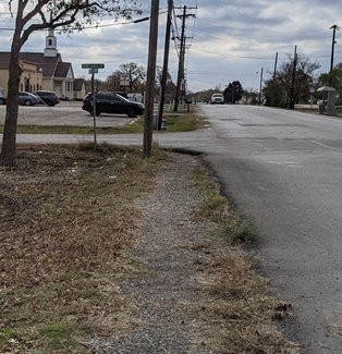
NCTCOG partnered with the City of Balch Springs to complete a corridor study of Hickory Tree Road, from Bruton Road to Elam Road (approx. 2 miles). The intent of this project was to provide recommendations to enhance bicycle and pedestrian safety and access to destinations on the corridor, provide congestion relief, and support economic development. The Hickory Tree Road Planning Study is now complete and ready for review.
NCTCOG presented the results of the planning study and recommendations at the 3/18/2022 Balch Springs City Council Meeting. The slides from this presentation can be found here.
Hickory Tree Road Planning Study Feedback Opportunity
NCTCOG and the City of Balch Springs hosted an online public engagement opportunity for all residents, visitors, and those employed in the City of Balch Springs to provide feedback on the Hickory Tree Road Planning Study.
The video presentation below reviews the planning study’s activities to date, including field visits and project activities, preliminary survey results, existing conditions on the corridor, major considerations, and preliminary recommendations for the roadway.
Timestamps: Introduction (0:00); Project Background & Goals (1:44): Data Collection/ Existing Conditions (7:24); Major Considerations (16:29); Preliminary Recommendations (19:07); Next Steps (30:46)
Presentation Slides
Links to Accompanying Resources
Roadway Usage Community Survey Question Results as of September 10, 2021
Stakeholder Meetings
Stakeholder meetings were held on June 29 and June 30 for residents and business owners/tenants who live or conduct business along the study corridor.
Residents Meeting (June 29):
Presentation
Summary
Business Owners/Tenants & Property Owners Meeting (June 30):
Presentation
Summary
Contact: Erin Curry
Click on the links below for additional Sustainable Development planning studies.
- Bike/Pedestrian Planning Studies
- TOD Planning Studies
| Project Name [PDF] |
Description |
City |
County |
Deliverable [PDF] |
| Southern Dallas County Infrastructure Analysis (2012) |
Framework and implementation program to support growth of Inland Port in Southern Dallas County to spur development. |
Dallas, Ferris, Hutchins, Lancaster, Wilmer |
Dallas |
Final Report |
| Project Name [PDF] |
Description |
City |
County |
Deliverable [PDF] |
| Hickory Tree Road Planning Study (2022) |
Study providing recommendations to enhance bicycle and pedestrian safety and access to destinations on the corridor, provide congestion relief, and support economic development. |
Balch Springs |
Dallas |
Final Report |
| LBJ Skillman Urban Planning Initiative (2014) |
Analysis of strategic opportunity vision areas resulting from reclaimed land after reconstruction of the IH 635 and Skillman Street interchange. |
Dallas |
Dallas |
Final Report |
| State Highway 5 Corridor Context Sensitive Master Plan (2014) |
Study investigating ways to revitalize the SH 5 corridor into a context-sensitive urban thoroughfare. |
McKinney |
Dallas |
Final Report |
| Northwest Highway and Preston Road Area Plan (2016) |
Study examining existing conditions, future needs, and recommended improvements in the Northwest Highway and Preston Road area. |
Dallas |
Dallas |
Final Report |
| State Highway 183 Corridor Master Plan, Phase I - River Oaks Blvd. (2016) |
Plan using context-sensitive design principles for SH 183 from SH 199 to the Trinity River to improve multimodal options and enhance livability in communities surrounding the NAS Fort Worth JRB. |
River Oaks |
Tarrant |
Final Report |
| State Highway 183 Corridor Master Plan, Phase II -Trinity River to IH 30 (2018) |
Plan using context-sensitive design principles for SH 183 from the Trinity River to I-30 to improve multimodal options, livability, and access to the NAS Fort Worth JRB. |
Westworth Village, White Settlement, Fort Worth |
Tarrant |
Final Report |
State Highway 199
(Jacksboro Highway) Corridor Master Plan (2017) |
Corridor master plan providing context-sensitive principles and recommendations to improve livability, provide transportation options, and improve drainage in the SH 199 corridor. |
Lake Worth, Sansom Park, Fort Worth, River Oaks |
Tarrant |
Final Report
Volume I
Volume II
Volume III
Volume IV |