Maps, Models & Data
The Travel Model Development and Data Management program area is responsible for the organization and use of travel-related information (including traffic counts) and assists to staff with mapping and analysis.
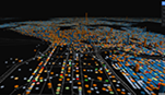
A travel demand model is a system of complex computer programs that includes inputs of roadway and transit networks and population/employment data used to output maps, statistics, and reports of how future travel will challenge our transportation systems.
Within our model, mathematical equations represent each individual's decision including the "Why," "When," "Where," and "How" for trips using various roads. The "What" is also considered by an individual's mode of travel choice that a user expects to complete a trip. O
|
Data management is how our planning organization uses the analysis of transportation-related data for national, state, and regional information, connecting performance of the overall development and use of transportation.
Traffic data can help measure travel speeds, changes in response, or behavior over time, as well as questions of how to prioritize in funding, research, and development.
|
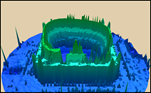
The maps we use are designed to help with the development, reporting, and monitoring of travel-related data (including traffic counts) and assist with specific projects and traffic-related analysis.
Mapping plays a major role in planning, development, and public outreach. Some of these maps support research work, planning regional development, and innovation with plans and projects around the region.
|