Community Paths
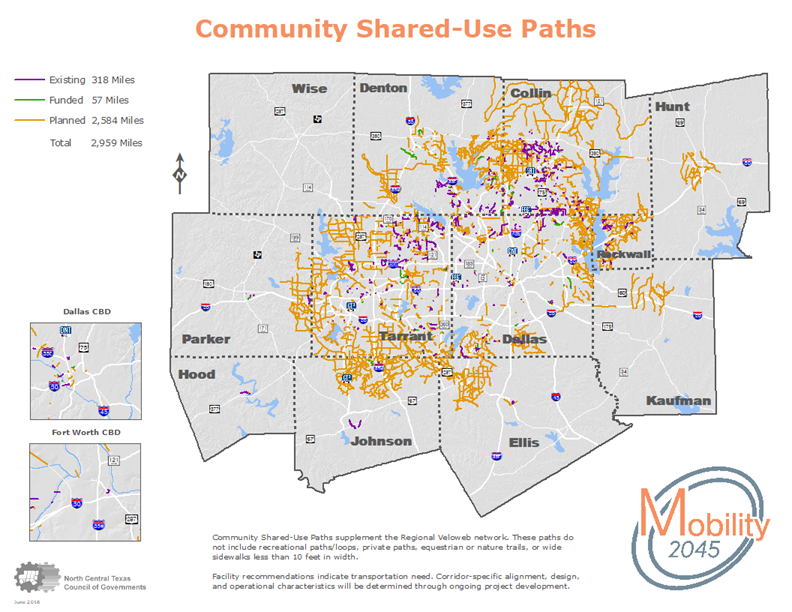
Community shared-use path facilities support the Regional Veloweb adopted as part of Mobility 2045 and help extend the reach of the Veloweb network by connecting it to local and neighborhood destinations. Approximately 2,959 miles of these paths are in various stages of development. These facilities are also expected to be consistent with the recommendations and guidance set forth by AASHTO for the development of bicycle facilities. This network of facilities does not include recreational park loops, private paths, equestrian or nature trails, or wide sidewalks less than ten feet in width. Mobility 2045 forecasts that a portion of the network of community shared-use paths will be implemented. The paths that will be constructed are primarily located in corridors that serve as extensions of the Regional Veloweb and provide connections to transit facilities and other local major destinations. While not fully funded by Mobility 2045, community shared-use paths may provide important connections within communities and will be implemented as funding is available.
Click on a link below to return to the Trails and On-Street Bikeways Network home page, view expanded maps and read more about the 2045 Regional Veloweb, on-street bikeways, and detailed county maps.