Surface Access
Surface Access to Aviation
The efficiency of air passenger and cargo mobility is affected by capacity at airports and on the surrounding highway system. Congestion in the air or on the ground can significantly impact aviation operations and efficiency. National and international trade rely on surface transportation connections with the region’s air passenger and cargo facilities. As the nation's largest inland port, the region relies on aviation and other intermodal connections to maintain global competitiveness.
Fulfilling the role of the MPO, NCTCOG performs analysis of surface access to regional aviation facilities. Future iterations of the Mobility 2035 Plan will include an inventory of specific improvements on the roadways surrounding the region’s aviation facilities. These inventories will be created to assist decision makers in prioritizing and funding these important connectors.

Travel Time Contours
Current Year vs. 2035 Travel Time Contours
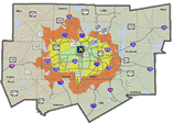
These travel time contour maps compare the travel times to/from our regional airports. This analysis was performed based on average PM peak period travel times as represented by the travel demand models under year 2035 conditions, taking into account current plan recommendations.
Surface Access Documentation
Regional Aviation Planning
North Texas Aviation Facilities Map
Staff Contacts: Natalie Bettger, Ernest Huffman