Trails and On-Street Bikeway Interactive Map
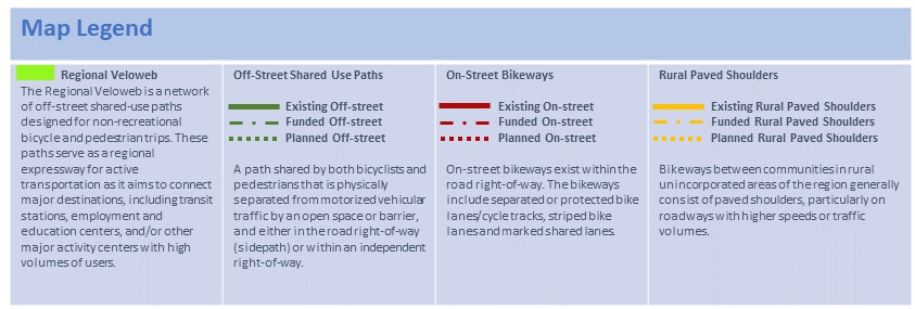
The 12-County Metropolitan Planning Area (MPA) trails and bikeway network is composed of the Regional Veloweb, community paths and on-street bikeways that provide regional and local connections. The interactive map below displays existing, funded and planned trails and bikeways in the MPA adopted as part of Mobility 2045. This network of facilities does not include recreational park loops, private paths, equestrian or nature trails, or wide sidewalks less than ten feet in width. The legend below the map provides an in-depth description for the different bicycle and pedestrian facilities included in the network. Click here for more about the Trails and On-Street Bikeways network. To view more information about city trails and bikeways, click here.
Note: To view the Planned and Funded bicycle facilities, click on the Layer icon in the map sidebar to display the different layers.
The regional trails and on-street bikeways network consists of shared-use paths (Regional Veloweb), supporting community shared-use pats, and the on-street bikeway network (including on-street wide shoulders in rural areas). This active transportation network plays a key role in supporting Mobility 2045 and the implementation of the multimodal Complete Streets and transit infrastructure that assist in safely accommodating all travelers throughout the region.
To activate and view more layers in the interactive map, please use the layer panel in the tool bar located in the upper left corner of the map. The Planned and Funded Bikeways layers can be seen when zoomed to the city level.
Visit our Trails and On-Street Bikeways Network page for more information about regional trails and on-street bikeways in North Texas.
* Bikeway data updated as of October 2018.