Community Rating System Users Group Meeting/Elected Officials Floodplain Seminar & CHARM Policy Workshop
 Thursday, July 18, 2019
9:00 a.m. to 12:15 p.m.
Networking Lunch from 12:15 p.m. to 1:30 p.m.
Earl Anthony Room, International Bowling Museum & Hall of Fame
621 Six Flags Drive, Arlington, TX 76011
 View Seminar Agenda (PDF)
 View Presentations (PDF 8.1 MB)
Elected Officials Seminar & Community Rating System Users Group Meeting
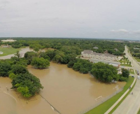 2015 Flooding of Walnut Creek and Magnolia, photo credit: Greg Cutler
Wednesday, July 18, 2018
12:00 p.m. – 2:00 p.m.
Transportation Council Room
NCTCOG Offices, CPII, 1st Floor
616 Six Flags Drive
Arlington, TX 76011
 View Seminar Agenda (PDF)
 View Presentations (PDF 36Mb)
Elected Officials Seminar & Community Rating System Users Group Meeting
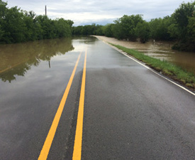 Flooded Road in Grand Prairie, 2015, photo credit: Barry Fulfer
Wednesday, August 23, 2017
12:00 p.m. – 2:30 p.m.
Transportation Council Room
NCTCOG Offices, CPII, 1st Floor
616 Six Flags Drive
Arlington, TX 76011
 View Seminar Agenda (PDF)
 View Presentations (PDF 4Mb)
Elected Officials Seminar & Community Rating System Users Group Meeting
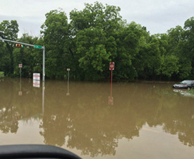 Flooded I-20 Service Road in Grand Prairie, 2015, photo credit: Barry Fulfer
Wednesday, August 31, 2016
12:00 p.m. – 2:00 p.m.
9-1-1 Training Center
NCTCOG Offices, CPIII, 2nd Floor
600 Six Flags Drive
Arlington, TX 76011
 View Seminar Agenda (PDF)
 View Presentations (PDF 36Mb)
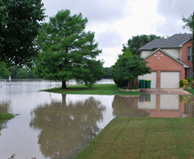 Flooded House near Rowlett Creek, 2015, photo credit: Dennis Abraham
Elected Officials Seminar & Community Rating System Users Group Meeting
Thursday, August 6, 2015
2:00 p.m. – 3:30 p.m.
William J. Pitstick Executive Board Room
NCTCOG Offices, CPII
616 Six Flags Drive
Arlington, TX 76011
 View Seminar Agenda (PDF)
 View Presentations (PDF 30Mb)
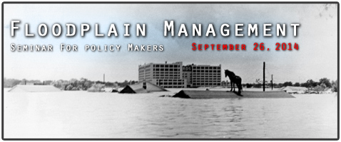
Photo credit: Flooded Homes Near Downtown Fort Worth in 1949 Flood of Trinity River, Photograph, n.d.; digital image, (http://texashistory.unt.edu/ark:/67531/metapth27968/ : University of North Texas Libraries, The Portal to Texas History, http://texashistory.unt.edu; crediting Tarrant County College NE, Heritage Room, Fort Worth, Texas.
Communities from across the region came together to collaborate on how to reduce the risks of flooding in their communities. The Policy Maker's Floodplain Management Seminar was held on September 26, 2014.
The purpose of this meeting was to be a conversation starter; highlighting the importance of partnerships in effective stormwater/floodplain management to our region's quality of life and public safety. This event was intended for elected officials, community leaders, and local decision-makers. It focuses on topics including floodplain management fundamentals, community partnerships & associations, and local programs. Speakers included representatives from the Federal Emergency Management Association, the U.S. Army Corps of Engineers, Texas Water Development Board, Texas Floodplain Management Association, the North Central Texas Council of Governments, and several of our local floodplain administrators.
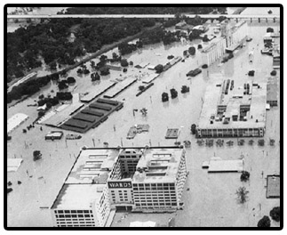 Photo credit: Flooded Homes Near Downtown Fort Worth in 1949 Flood of Trinity River, Photograph, n.d.; digital image, (http://texashistory.unt.edu/ark:/67531/metapth27968/ : University of North Texas Libraries, The Portal to Texas History, http://texashistory.unt.edu; crediting Tarrant County College NE, Heritage Room, Fort Worth, Texas.
Friday, September 26, 2014
9:00 a.m. – 11:00 a.m.
Metroplex Conference Room
NCTCOG Offices, CP II
616 Six Flags Drive
Arlington, TX 76011
 View Seminar Agenda (PDF)
 View Presentations (PDF 14Mb)