Upper Trinity River Transportation and Stormwater Infrastructure Project
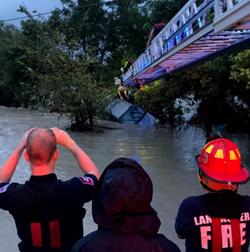 Recent flood events in Texas have brought to the attention of the State the need for more comprehensive planning in urban areas. This is particularly important in the upstream portions of the Trinity watershed where urban growth and development is expected to continue and where unmanaged growth will have strongly negative consequences on downstream communities like Dallas and Fort Worth. The North Central Texas region has a distinct window of opportunity to proactively engage in comprehensive planning efforts that integrate its transportation, environmental and stormwater needs in order to address the health, safety, and welfare concerns of the region while helping local governments manage their growth and development in a cost effective manner.
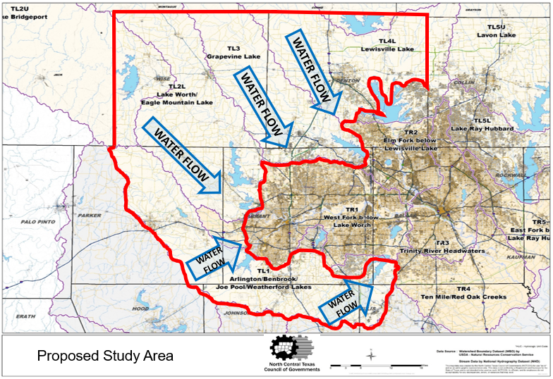
NCTCOG is currently pursuing funding from multiple partners and agencies to carry out Integrated Long-Range Planning of Regional Transportation and Stormwater Management in the western-most portion of the 16-county region that is also within the watersheds of the various Trinity River branches. The project area includes Wise County and portions of Dallas, Denton, Ellis, Hood, Johnson, Parker, and Tarrant counties. Common community development master plans incorporate roadways, water/wastewater infrastructure, parks, solid waste needs, and fire and police stations, yet stormwater is treated as “drainage as you build.” To learn from development mistakes of the past that have resulted in flooded roadways, neighborhoods, critical infrastructure, and businesses, NCTCOG wants to assist communities’ mitigation of these impacts before they happen through integrating long-range stormwater planning and creating a process that can be replicated nationwide. Goals and deliverables include: inventory of relevant data and stormwater management structures, land inventory and site-specific design considerations, plans to offset future transportation and indirect development impacts, and implementation with policy and mapping products and technical tools. Modeling and maps will be provided to cities and counties as a final product to assist them in regionally endorsed higher standards. The overall project is estimated to take 5 years once funding from multiple sources is secured.
TWDB 2021 Executed Grant Agreement