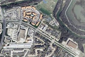
High-Accuracy Orthophotography

Orthophotography is aerial photography which has been geometrically corrected (“orthorectified”) so that it has a uniform scale and can be used for measuring just like a traditional map. Since 2001, NCTCOG's Research & Information Services (RIS) Department has facilitated the purchase of high-quality, color, digital aerial photography (orthos) for North Central Texas as a cost-sharing objective for local governments and other entities.
NCTCOG's high-accuracy orthophotography is captured in 4-bands (includes NIR band) at either 3" or 6" resolution. The final aerial photography meets The American Society of Photogrammetry and Remote Sensing (ASPRS) Class I standard for 1” = 50 (RMSE +/- 0.5 ft) and 1"=100' (RMSE +/- 1.0 ft) scale and is suitable for engineering grade analysis. NCTCOG flies this type of orthophotography once a year during the leaf-off season (Dec-March). The imagery undergoes extensive processing and QC by the chosen vendor before delivering 4-6 months after acquisition.
The major two technologies for aerial large format digital imaging are the frame imaging approach as implemented in the Microsoft-UltraCam and the Intergraph-DMC and the linear array technology (Pushbroom) by Leica in their ADS-40 and up. The large format framing cameras “stitch“ an image from individually collected smaller image segments or tiles with a sophisticated technology to ensure a geometrically accurate and seamless single large format image. Pushbroom orthophotography produces one large file per linear array and flight line and is especially good for large regional flights. Either system can be used to acquire highly accurate orthophotography. When planning a project, NCTCOG will determine the best camera to use based upon project size and layout.
Due to the success of the project and subsequent realized savings, a majority of the local governments in North Central Texas purchase high-accuracy orthophotography through NCTCOG's cooperative program. Historically, larger "region-wide" flights occur in odd-years and smaller "as-needed" flights occur in even-years. The scope of any project is dependent upon the needs of that year’s participating entities.
New Acquisition Orthophotography Pricing (square mile)
The prices below are the bulk prices that have been negotiated with the vendor. They do not include the additional cost-sharing discounts that occur during larger region-wide "cooperative" flights. All projects require a 2 square mile minimum.
| |
2-250 |
251-500 |
501-1000 |
1001-5000 |
5001-10,000 |
>10,000 |
| 3" Frame Orthophotography |
$385.00 |
$357.50 |
$330.00 |
$302.50 |
$247.50 |
$236.50 |
| 6" Frame Orthophotography |
$192.50 |
$154.00 |
$143.00 |
$132.00 |
$121.00 |
$110.00 |
| 6" Pushbroom Orthophotography |
$137.50 |
$121.00 |
$103.40 |
$93.50 |
$85.80 |
$80.30 |
| 6” Oblique Imagery |
$770.00 |
$341.00 |
$313.50 |
$302.50 |
$291.50 |
$275.00 |
Aerial imagery from past projects may be viewed and printed from DFWMaps and purchased in digital format after a project completes through the DFWMaps Marketplace. For more information on orthophotography, visit the SDCP FAQ page or send us an email.
Past Cooperative Orthophotography Projects
2019 Orthophotography
2017 Orthophotography
2015 Orthophotography
2013 Orthophotography
2011 Orthophotography
2009 Orthophotography
2007 Orthophotography
2005 Orthophotography
2003 Orthophotography
2001 Orthophotography